Biodiversity header: Prairie sunset
Oklahoma Biological Survey logo
Biological Survey Home
Navigation
Welcome
History
Maps
Photographs
Research Publications
Current Research
Teaching
Using Oliver's Woods
Species Checklists
Tree Species Ecology
Oklahoma Natural Areas Registry logo


Oliver Wildlife Preserve

Maps

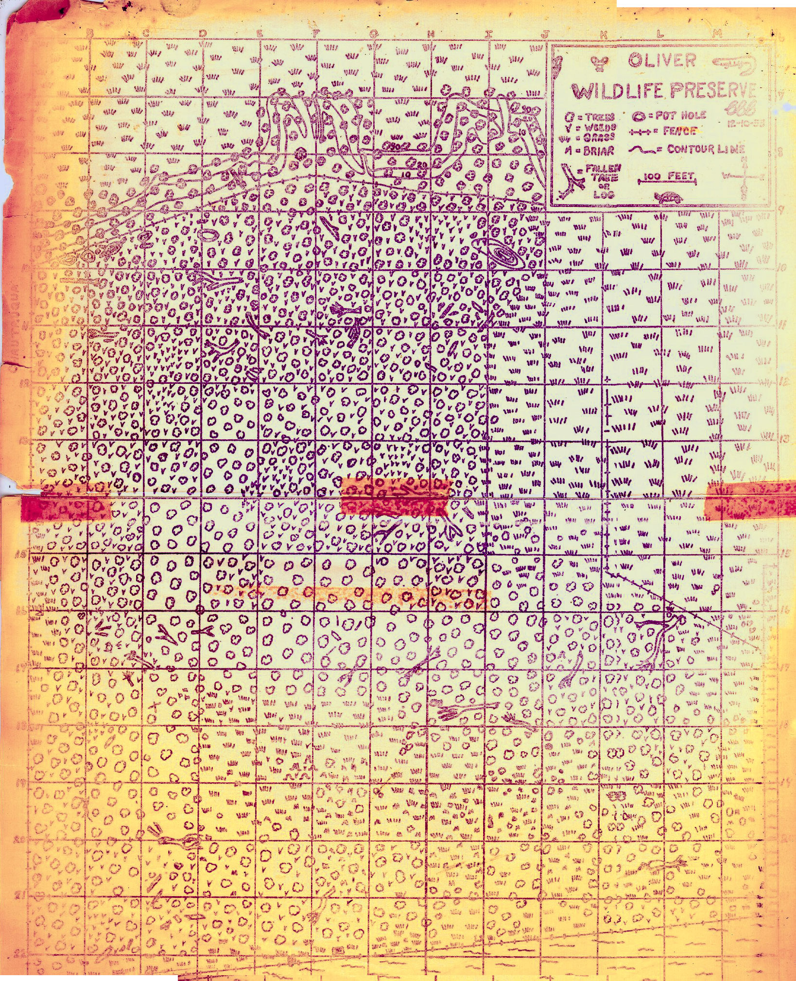
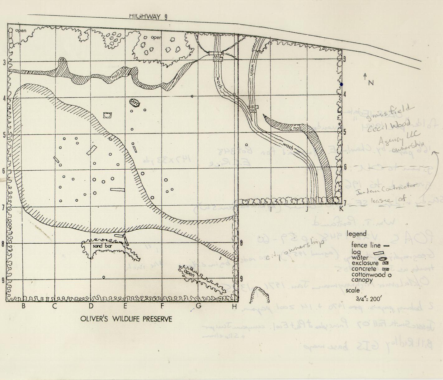
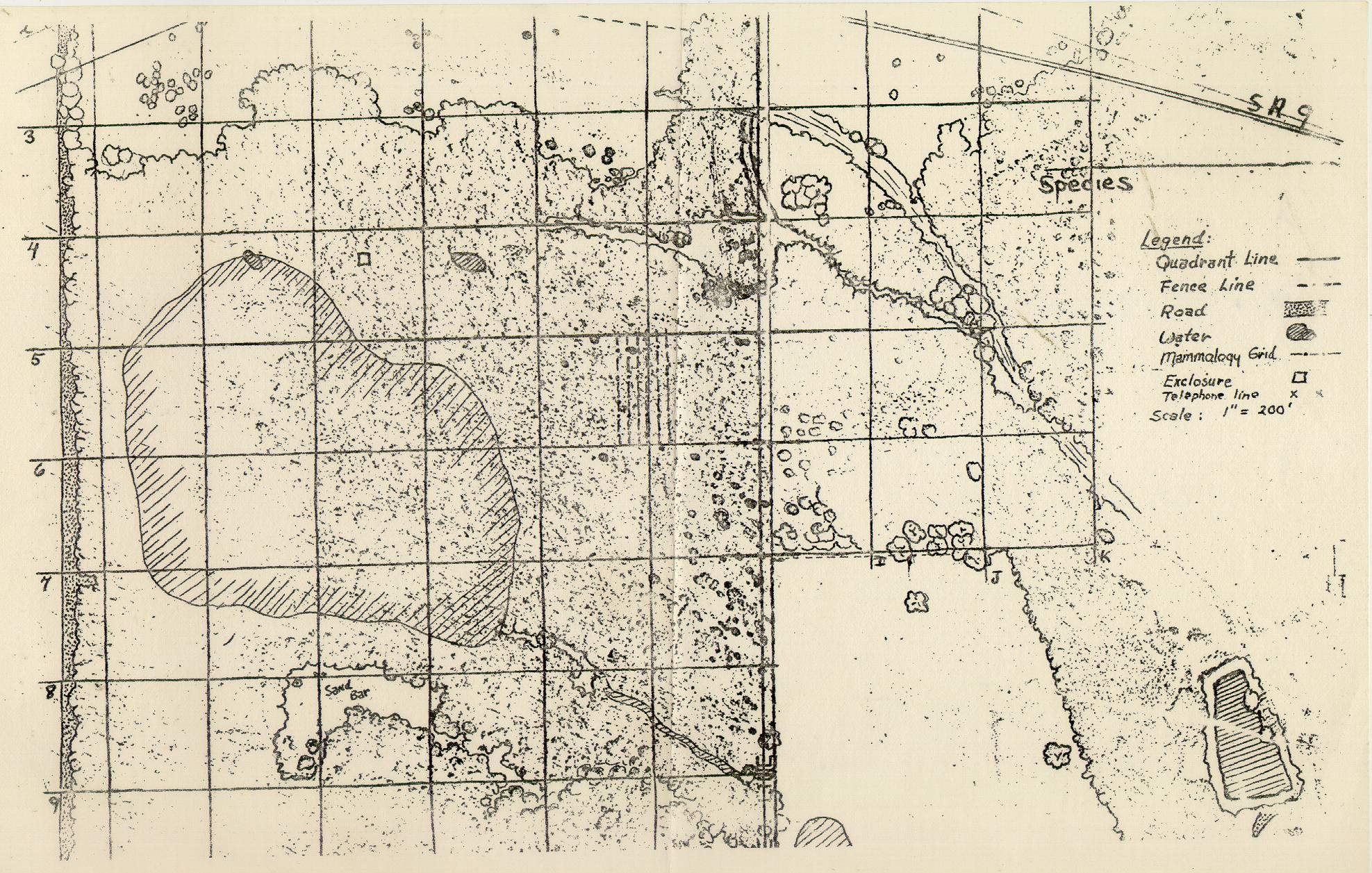
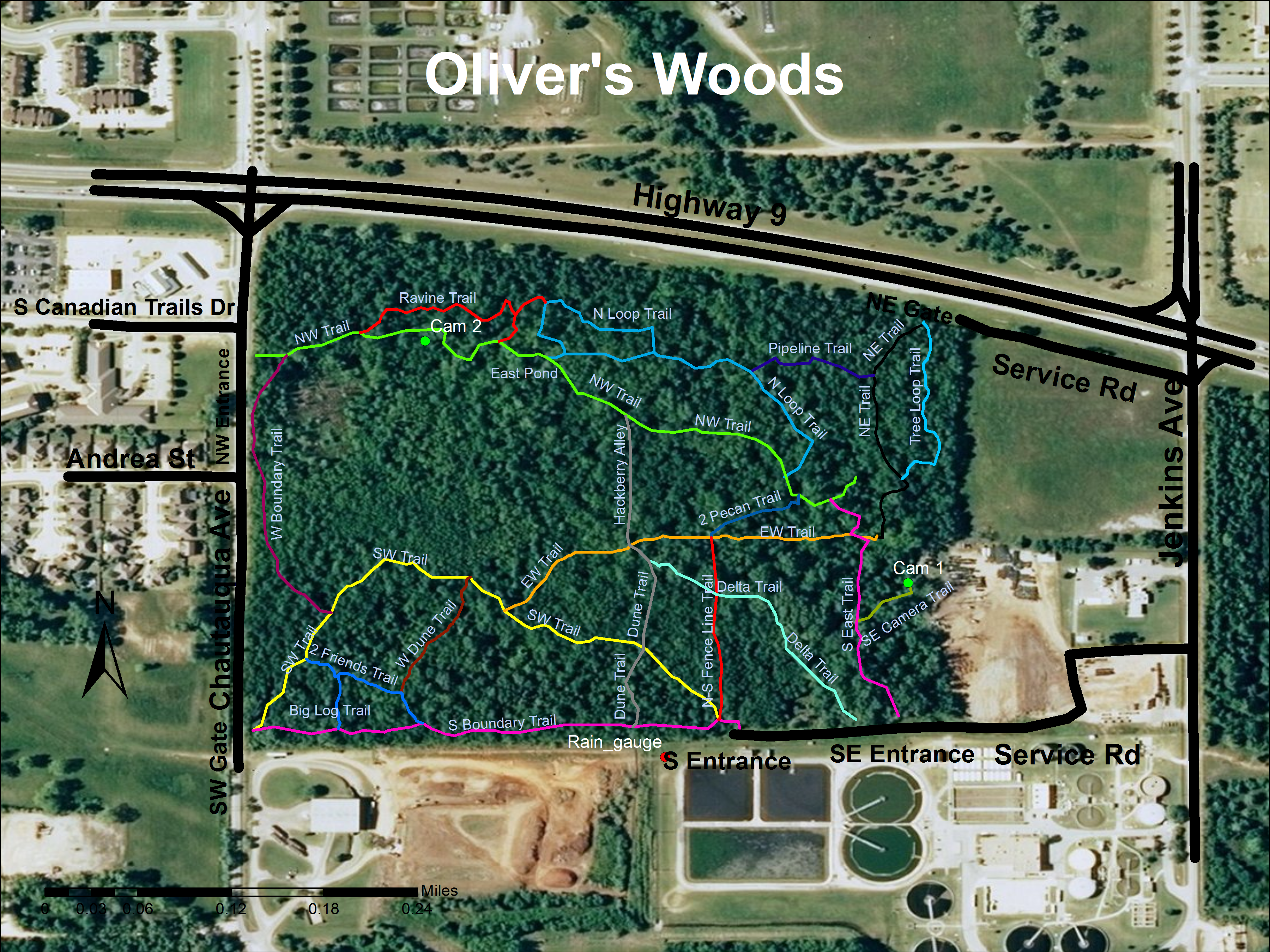
Oliver's Woods have been the subject of several mapping projects. Below you will find images of many of the maps made of the woods. Including vegetation maps made in the 1950s and recent maps of large tree records.

1953 map

February 1997

Map from 1970

Map for 1975 Ethoecology class

Printable Map Olivers Woods 2012

Map Oliver's Woods trails Sept 2012

Soils Map, from Jason Julian's Geography Soils class projects.

This page is sponsored by the Oklahoma Biological Survey
OU logo
Disclaimer